Itakhola Mura:
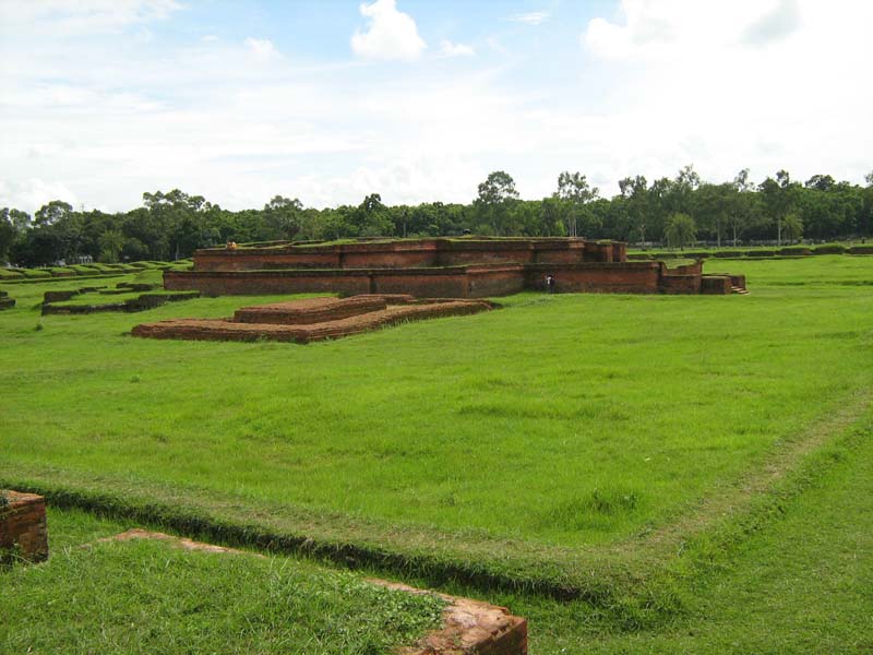
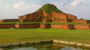
The archaeological remains of Itakhola Mura lie in three terraces on the hillock opposite to the Rupban Mura site across the Kotbari road. It served for long as a quarry for old bricks and hence the name. Excavations have revealed here a grand stupa complex with an attached monastery to its north. Of the five cultural phases the earlier three lie buried underneath the later remains. Mentionable antiquities from the site, besides the stucco image, are three round pellets of solid gold (19 tolas) and a copperplate, which is still to be deciphered.
Rupban Mura:
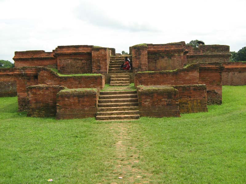
Rupban Mura is an important site, lies on a hillock between modern BARD and BDR establishments in the Kotbari area on the south of the Comilla-Kalirbazar road. Excavations have revealed here the remains of a remarkable semi-cruciform shrine together with other subsidiary structures. Deep diggings have revealed three main periods of building and rebuilding, the earliest of which correspond to c.6th - 7th centuries AD. Very little of the last period remains (10th - 11th centuries AD) survive now in this very heavily disturbed site. Significant discoveries from the site include, besides the colossal stone Buddha, five debased gold coins of Balabhatta, the Khadga ruler.
Mainamati Museum:
The Mainamati site Museum has a rich and varied collection of copper plates, gold and silver coins and 86 bronze objects. Over 150 bronze statues have been recovered mostly from the monastic cells, bronze stupas, stone sculptures and hundreds of terracotta plaques each measuring on an average of 9" high and 8" to 12" wide. Mainamati is only 114 km. from Dhaka City.
Mainamati War Cemetery:
World War II Cemetery, where the bodies of 723 soldiers of the allied forces along with the bodies of some Japanese soldiers are lying is unforgettable. This cemetery located about 3.1 km away from Comilla Cantonment, which was a frontier military base in the fight against the Japanese who had occupied Burma. British Army soldiers who were killed during fighting the Japanese Army at the Burma (Myanmar) frontier are buried here. The British Government allocates financial aid to maintain this cemetery.
Shrine of Sultan Bayazid Bostami:
This holy shrine attracts a large number of visitors and pilgrims. At its base there is a large pond with several hundred tortoises floating in the water. According to tradition, these turtles are descendants of evil spirits (djinn) who were cast into this shape because they incurred the wrath of the great saint who visited the place about 1100 years ago.
Foy's Lake:
Set amidst panoramic surroundings, this ideal spot for outings and picnics is thronged by thousands of visitors. This Lake has been created in the natural environment in 1924 by the initiative of the then Asam-Bengal Railway. This lake has been created by building a dam based on a plan by an English engineer Mr. Foy. Now an amusement park is established there.
Patenga Sea Beach:
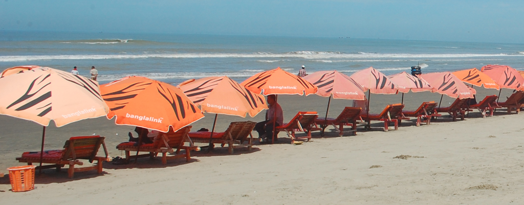
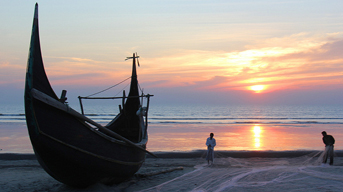
It is a natural beauty spot. Here is the confluence of the river Karnaphuli and the Bay of Bengal. The beach has been protected from erosion by the bay with help of boulders. There is the sandy beach from which one can find the waters of the bay. Visitors can have a view of the bay sitting on the heaps of boulders, walk along the sandy beach or can enjoy the illusive touch of the little of the setting sun. The beach is stressed up to 22km. It is 20 km. away from the Zero Point. The natural beauty of Patenga sea beach attracts thousands of visitors almost daily.
World War II Cemetery:
In this well-preserved cemetery at quiet and picturesque place, 755 soldiers from commonwealth countries and Japan were buried, who were killed in the Indo-Burmese front during the World War II. The War Cemetery is located in a hillside sloping place, in the south-western corner of Chittagong Medical College Hospital. The total area of this cemetery is eight acres, which is protected and supervised by the Common wealth Graves Commission.
Ethnological Museum:
This museum located in Agrabad is a treasure house of a variety of tribal culture and heritage of Bangladesh. It was established in the first half of nineteen sixties. The museum contains four galleries and a small hall. The museum houses a selection of objects associated with the 12 ethnic tribes of Bangladesh and also of many tribes of Australia, India and Pakistan.
Ramu:
This is a typical Buddhist village, about 16 km. from Cox's Bazar, on the main road to Chittagong. There are monasteries, khyangs and pagodas containing images of Buddha in gold, bronze and other metals inlaid with precious stones.
One of the most interesting of these temples is on the bank of the Baghkhali river. It houses not only interesting relics and Burmes handicrafts but also a large bronze statue of Buddha measuring thirteen feet high and rests on a six feet high pedestal. The wood carving of this khyang is very delicate and refined.
The village has a charm of its own. Weavers ply there trade in open workshops and craftsmen make handmade cigars in their pagoda like houses.
Maheshkhali:
It is another attraction for the tourists who go to Cox's Bazaar. An island off the coast of Cox's Bazar. It has an area of 268 square kilometers. Through the center of the island and along the eastern coastline rises, a range of low hills, 300 feet high; but the coast to the west and north is a low-lying treat, fringed by mangrove jungle. In the hills on the coast is built the shrine of Adinath, dedicated to Siva. By its side on the same hill is Buddhist Pagoda.
The island offers panoramic scenic beauty and is covered by low hills and mangrove forests. This island is famous for Buddhist Temple and Pagoda.
Rangamati:
Rangamati District with an area of 6116.13 sq km is bounded by the Tripura State of India on the north, Bandarban district on the south, Mizoram State of India and Chin State of Myanmar on the east, Khagrachhari and Chittagong districts on the west.
From Chittagong a 77 km. road amidst green fields and winding hills will take you to Rangamati, the headquarters of Rangamati Hill District which is a wonderful repository of scenic splendors with flora and fauna of varied descriptions. The township is located on the western bank of the Kaptai Lake. Rangamati is a favorite holiday resort because of its beautiful landscape, scenic beauty, lake, colorful tribes (Chakma, Marma etc.) its flora and fauna, tribal museum, hanging bridge, homespun textile products, ivory ornaments and the tribal men and women who fashion them. For tourists the attractions of Rangamati are numerous, tribal life, fishing, speed boat cruising, water skiing, hiking, bathing or merely enjoying nature as it is.
Kaptai Lake:
Kaptai Lake is the largest man-made freshwater body in Bangladesh. Though created primarily for hydroelectric power generation, it contributes to produce significant quantity of freshwater fishes, navigation, flood control and agriculture, etc. The reservoir was created by damming the river Karnafuli near Kaptai town in the Chittagong Hill Tracts. The lake is confined within the hill district Rangamati and embraces the upazilas of Rangamati Sadar, Kaptai, Nannerchar, Langadu, Baghaichhari, Barkal, Juraichhari and Belaichhari.
Bandarban:
Ninety two kilometer from Chittagong by metal led road, Bandarban is the district headquarters of the Bandarban Hill District. Bandarban is the home town of the Bohmong Chief who is the head of the Mogh tribe. The Moghs are of Myanmar origin and Buddhists by religion, jovial and carefree by nature. The moghs are simple and hospitable people .Bandarban is also the home of the Murangs who are famous for their music and dance. Several other tribes of great interest live in the remote areas of the district. The highest peak of Bangladesh-Tahjindong (4632 ft) is located in the Bandarban district.
Lots of hills and hilly areas, waterfalls, River Sangu, Lakes and the tribal culture are the main attraction of Bandarban. Chimbuk hill is one of the major attractions of Bandarban. One can enjoy the journey to Chimbuk Hill by jig jag hilly roads. It's the third highest mountain in Bangladesh of approx. 3000 ft height.
